
AI Drone Inspection
Capture every detail
from a safe distance.
Inspect every tower in full 3D—safely, quickly, and from any angle.
Turn physical towers
into digital twins.
We convert high-resolution drone photos into millimeter-accurate 3D models. Inspect antennas, measure orientations, and audit structural health with zero tower climbs.
Detect structural faults
before they cause outages.
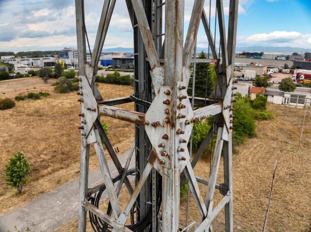
Identify rust, loose hardware, and damaged connector boots before they cause network downtime. Every observation is cross-referenced with high-resolution drone photos from the exact capture angle.
HOW IT WORKS
From Flight to Report in 4 Simple Steps
A completely automated reality capture workflow designed for telecom operators and tower owners. Zero climbing, zero guesswork.
Automated 15-min flight, zero tower climbing. High-resolution sensors capture overlapping 4K photos safely from the ground.
Photogrammetry turns photos into an accurate 3D replica. Cloud processing generates a millimeter-precise digital twin of the tower.
Finds antennas, RNUs, dishes, and flags rust/weatherproofing defects. Automated vision measures azimuth, tilt, and RAD center.
Export complete audit dossiers directly to PDF. Comprehensive engineering and commercial reports ready for operations and billing.
A complete solution for
scaled inspection operations.
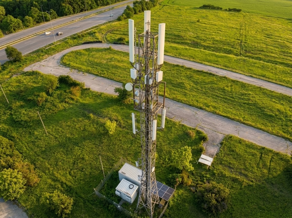
Pre-programmed vertical orbits capture 300+ high-resolution 4K photos in under 15 minutes. 100% ground-based with zero climbing.
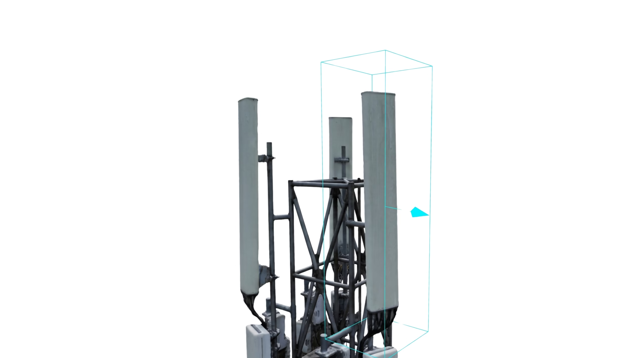
Rotate, zoom, and inspect every antenna, mount, and steel member down to sub-centimeter accuracy directly in your browser.
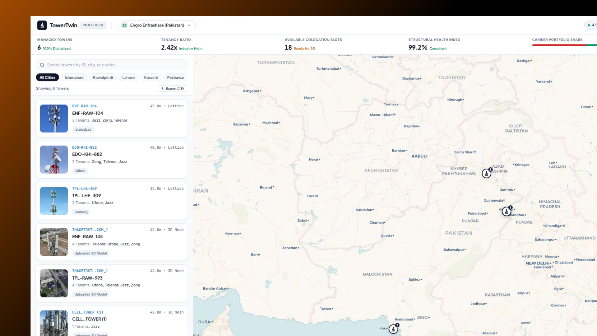
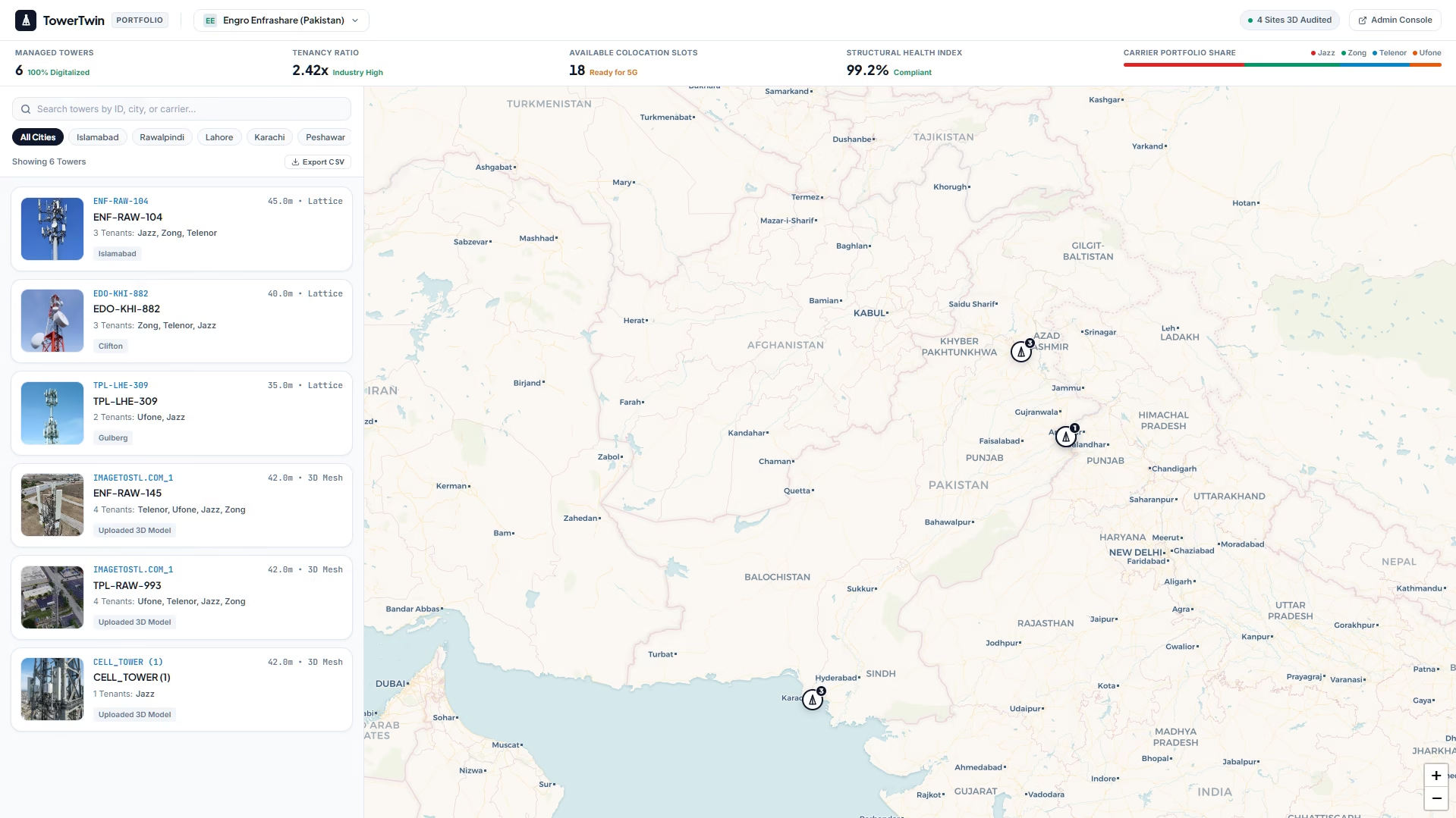
Centralized platform managing your entire nationwide tower portfolio with live colocation capacity, tenancy ratios, and structural health tracking.
Automated flight execution with centimeter RTK spatial accuracy, live 4K camera transmission, and instant cloud sync.
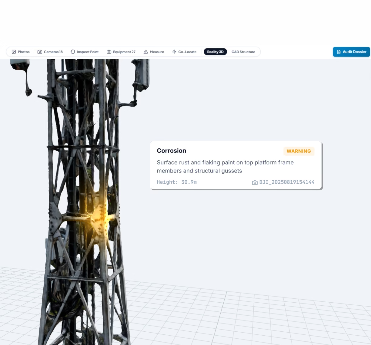
Deep learning algorithms automatically classify antenna models, calculate azimuth and tilt, and flag structural rust and cable defects.
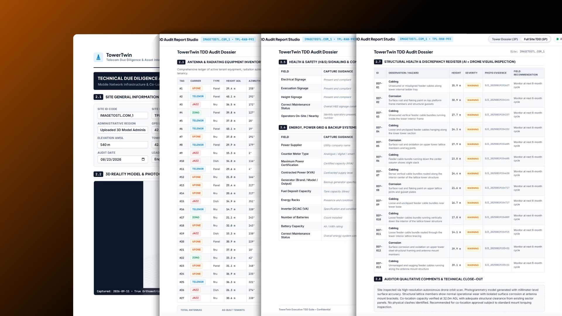
Export standardized, engineering-grade audit reports with full 4K photo proof in seconds, ready for executive sign-off and billing.
Put autonomous aerial capture
to work for your inspections.
Get started
Manage every cell site from one dashboard.
See live tenant allocations, track structural compliance, and inspect 3D models without leaving your desk.
Zero climb risk.
Complete site visibility.
Frequently Asked Questions
What drone hardware do we need to capture towers?
TowerTwin works with any standard commercial drone equipped with a 20MP+ camera and RTK GPS, such as the DJI Mavic 3 Enterprise. No specialized LiDAR sensors are required.
How accurate is the 3D model compared to manual climbing?
Our photogrammetry engine produces sub-centimeter spatial accuracy. You can measure antenna RAD centers, tilt, azimuth, mount standoff distances, and structural member dimensions with engineering precision.
How does the contract discrepancy register work?
TowerTwin automatically catalogues every physical antenna, RRU, and microwave dish mounted on the tower and compares it against your recorded tenant lease agreements. Any unbilled or unauthorized hardware is flagged immediately.
How long does it take from flight to completed audit report?
A typical drone flight takes about 15 minutes. Once photos are uploaded, 3D reconstruction and automated component tagging take just a few hours. Complete PDF dossiers are ready the same day.
Can multiple team members inspect towers simultaneously?
Yes. TowerTwin is completely cloud-based. Structural engineers, lease administrators, and field managers can review the same 3D digital twin, annotate defects, and verify equipment from any modern web browser.